


Aerial Photographs Vintage

Royersford Spring City PA 1946 Aerial Photographic Print
Birds eye photographic view of Royersford and Spring City. This colorized 1946 map shows the Schuylkill river running between the two cities. The Schuylkill canal can be seen on the Chester county side running parallel to the river. Today, the canal has been filled in. The warehouses along the Royersford side of the river in Montgomery county have been torn down and replaced with apartments. View this in our Zazzle Store
$12.00
-
Phoenixville Mont Clare 1937 Aerial Map PA Print
Vintage 1937 aerial photograph of Phoenixville and Mont Clare with the Schuylkill river and canal flowing between them. The Schuylkill river divide Montgomery and Chester counties. The photo the Phoenixville iron works that has been demolished with the property turned into an apartment complex. Black Rock dam and the canal through Mont Clare can be seen. The Schuylkill river trail runs along the canal. View this in our Zazzle Store
$12.00
-
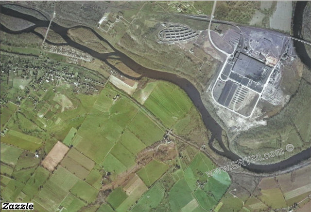
Phoenixville Mont Clare PA 1947 Aerial Photograph
Vintage 1947 aerial photograph of Phoenixville and Mont Clare with the Schuylkill river and canal flowing between them. The Schuylkill river divides Montgomery and Chester counties. The photograph shows the Phoenixville iron works, that has since been demolished. Black Rock dam and the canal through Mont Clare can be seen. The Schuylkill river trail runs along the canal. Black Roc Sanctuary is enclosed in the river loop at the top. View this in our Zazzle Store
$12.00
-
Kenilworth PA 1946 Aerial Photograph Print
Vintage 1946 aerial photograph of the Schuylkill river and canal. Showing the village of Kenilworth. North and East Coventry townships in Chester County Pennsylvania. North of the Schuylkill river is Pottstown in Montgomery County.View this in our Zazzle Store
$12.00